News
Joburg on Storm Watch: Residents Urged to Stay Safe as Severe Thunderstorms Loom

Joburg braces for another stormy Friday
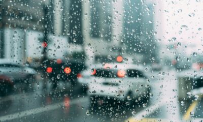
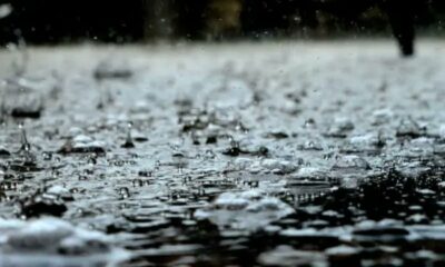
Johannesburg residents are being urged to prepare for yet another round of severe thunderstorms on Friday, with emergency services across the city on high alert. After a chaotic Thursday of heavy downpours and flash floods that turned roads into rivers, the SA Weather Service (SAWS) has warned that conditions could worsen before they improve.
A city soaked and struggling
Thursday’s storms left parts of Gauteng battling flash floods, gridlocked traffic, and damaged infrastructure. Videos and pictures flooded social media showing cars submerged in water, motorists stranded on highways, and residents wading through flooded streets.
According to the Gauteng Provincial Joint Operations Committee, areas like Alberton, Bedfordview (particularly near the N3/Gillooly’s interchange), Crown Mines, Primrose, Krugersdorp, Buccleuch, and Sunninghill were among the hardest hit.
Emergency workers spent much of the evening responding to calls for help, from rescuing trapped motorists to assisting residents whose homes had taken in water.
Authorities on high alert
Joburg Emergency Management Services (EMS) spokesperson Robert Mulaudzi confirmed that the city remains in a “high alert” state.
“We’re monitoring all areas, especially low-lying communities and informal settlements. Our aquatic rescue unit is ready to respond to any flash flood incidents,” he said.
Mulaudzi urged motorists to drive carefully, maintain a safe following distance, and above all, avoid attempting to cross flooded roads or bridges.
“It only takes a small amount of moving water to sweep a car off the road. Please don’t take the risk,” he added.
Why this matters
For Joburgers, summer storms are nothing new, but climate experts warn that the intensity and frequency of such storms are increasing due to climate change and urban sprawl. Blocked drains, inadequate stormwater infrastructure, and overbuilt areas exacerbate the risk of flooding, especially in older suburbs and informal settlements.
Beyond Gauteng: A weekend of weather extremes
The weather rollercoaster doesn’t stop in Johannesburg. SAWS has also issued thunderstorm warnings for the North West, Mpumalanga, Northern Cape, and Free State. Meanwhile, the Western Cape faces the opposite problem a heatwave.
Communities in Matzikama and Bergrivier can expect blistering conditions until Sunday, with temperatures soaring and a yellow-level 1 warning for damaging coastal winds between Cape Columbine and Cape Agulhas.
Social media reaction: “Not again, Joburg!”
Online, Joburg residents are venting frustration and humor about the city’s ongoing weather woes. Memes of floating taxis, drenched commuters, and flooded intersections have been circulating widely.
One user on X (formerly Twitter) quipped, “At this point, I need a canoe to get to work.” Another posted, “When SAWS says thunderstorm, Joburg hears ‘free swimming lessons’.”
Despite the jokes, many also voiced concern about the city’s lack of preparation, especially in areas where drainage systems remain neglected.
What to do if the storm hits
Authorities are reminding residents to:
-
Avoid crossing flooded bridges or roads.
-
Unplug appliances during lightning storms.
-
Keep emergency contacts handy.
-
Move to higher ground if water levels rise near your home.
Johannesburg’s summer storms can be as unpredictable as they are powerful and this weekend is shaping up to be another wild one. While the skies prepare to open once again, Joburg EMS, weather forecasters, and residents alike are hoping for the best and preparing for the worst.
As Mulaudzi put it, “The best protection is prevention. Stay alert, stay indoors if you can, and don’t underestimate the power of water.”
{Source: The Citizen}
Follow Joburg ETC on Facebook, Twitter , TikTok and Instagram
For more News in Johannesburg, visit joburgetc.com