Four more days of rain: When South Africa can expect a break in the weather
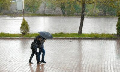
If it feels like the rain just won’t let up, you’re not imagining it.
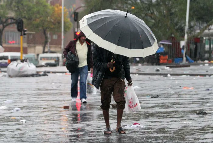
Across large parts of South Africa, umbrellas are staying within arm’s reach as another stretch of wet, stormy weather settles in. And according to forecasters, the soggy spell isn’t over just yet.
A slow, grey start to the week
The week kicks off under thick cloud cover, especially over the eastern parts of the country. According to the South African Weather Service, conditions will remain cool and overcast in these regions, while central areas can expect a mix of warmth and scattered showers.
KwaZulu-Natal, in particular, is in for a soaking with widespread rain already setting the tone early in the week.
Weather forecaster Juandre Vorster better known online as the “Weather Hooligan” says the pattern is unlikely to shift quickly.
“Expect rain through most of the week,” he explained, adding that clearer skies are only likely to return around Thursday into Friday.
Severe thunderstorm warnings in multiple provinces
It’s not just light showers on the radar. A yellow level 4 warning has been issued for severe thunderstorms across several provinces, including:
- Gauteng
- Free State
- North West
- Mpumalanga
- KwaZulu-Natal
- Northern Cape
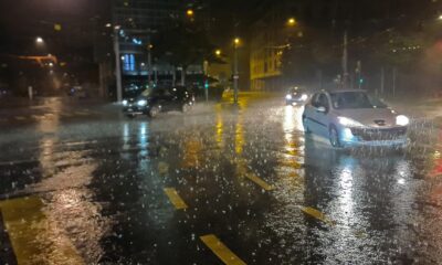
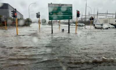
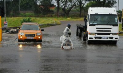
These storms could bring heavy downpours, strong winds, and localised flooding the kind of weather that turns afternoon traffic into a crawl and leaves informal settlements especially vulnerable.
Weekend rain already made its mark
Some areas have already seen significant rainfall. Over the weekend:
- Krugersdorp recorded a hefty 100mm
- Pretoria saw around 11mm
- Johannesburg recorded 17mm
- Secunda and Ermelo in Mpumalanga received between 22mm and 32mm
- Ventersdorp in North West reached 47mm
- Bethlehem in the Free State saw 29mm
It’s the kind of rain that fills dams and tests drainage systems.
Farmers welcome the rain, but it’s a balancing act
While city dwellers might be counting the days until sunshine returns, for farmers, this rain comes at a crucial moment.
Bennie van Zyl says the country is entering a sensitive pre-harvest period in summer rainfall regions. Crops like maize still need moisture to fully develop.
“It’s a bit of a seesaw,” he explains. Too little rain can stunt growth, but too much at the wrong time can delay harvesting or damage crops.
Right now, though, many farmers are cautiously optimistic hoping the rain lands just right.
Dam levels paint a positive picture
There’s some good news beneath the clouds.
According to the Department of Water and Sanitation, South Africa’s dams remain in a strong position, sitting at around 95.7% capacity nationally.
Spokesperson Wisane Mavasa highlighted notable increases in some regions, with Limpopo and the Northern Cape seeing gains.
One standout: the Middle Letaba Dam has reached 105% capacity for the first time in over two decades. Meanwhile, the Vaal Dam has edged up past the full mark again.
So… when will it finally clear?
If you’re planning anything outdoors, patience is key.
Rain and stormy conditions are expected to linger for the next few days, with a gradual clearing trend only expected from Thursday into Friday.
Until then, it’s a familiar South African scene:
wet roads, dramatic afternoon skies, and social media filled with videos of flooded streets and booming thunder.
This kind of late-season rain isn’t unusual, but it always sparks conversation.
For some, it’s an inconvenience. For others, it’s a lifeline. And in a country where water security is always top of mind, full dams and healthy crops are a reminder that even relentless rain has its upside.
So for now, keep the umbrella close, sunshine is coming, just not today.