News
Brace Yourself: Storms and Extreme Fire Danger Set to Hit Parts of South Africa
Brace Yourself: Storms and Extreme Fire Danger Set to Hit Parts of South Africa
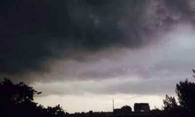
South Africans are being urged to keep one eye on the sky and the other on official alerts as intense weather conditions roll in on Friday, 9 January. From heavy thunderstorms to dangerously dry fire conditions, parts of the country are in for a volatile day and authorities are warning residents not to take it lightly.
The forecast, issued ahead of the weekend, paints a picture of sharp contrasts: soaking rain and hail in some areas, while others face scorching heat and an elevated fire risk.
North West: Storms and Fire Risk Collide
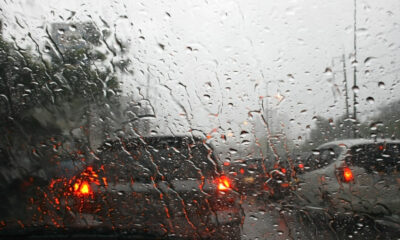
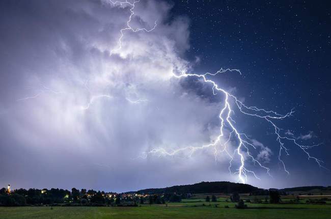
The extreme eastern parts of the North West are under a Yellow Level 2 warning for severe thunderstorms. These storms are expected to bring heavy rain, damaging winds, excessive lightning and hail, raising the risk of localised flooding and damage to property.
At the same time, extreme fire danger conditions are predicted across parts of the province a worrying combination that residents in rural and farming communities know all too well. Dry vegetation and sudden winds could cause fires to spread rapidly.
Mahikeng forecast
Mahikeng is expected to start the day fine before becoming partly cloudy later, with isolated afternoon showers and thundershowers. Temperatures will range between 20°C and 33°C, making it a hot and unsettled day.
KwaZulu-Natal: Afternoon Storms on the Way
KwaZulu-Natal is also feeling the effects, with a Yellow Level 2 warning in place for the western and central regions of the province.
Thunderstorms are expected to develop later in the day a familiar summer pattern for locals, but still capable of causing disruptions, especially during peak travel hours.
Durban forecast
Durban residents can expect partly cloudy conditions with scattered afternoon showers and thundershowers. Temperatures will be milder along the coast, sitting between 22°C and 27°C.
On social media, Durbanites have already begun joking about sudden downpours catching beachgoers off guard a reminder of how quickly conditions can turn.
Free State: High Alert for Storms and Fires
The Free State faces a particularly challenging day, with severe thunderstorms and extremely high fire danger conditions forecast in parts of the province.
A Level 2 warning has been issued for the extreme eastern areas, where storms may bring heavy rain, strong winds, lightning and hail. These conditions could lead to localised flooding and damage to infrastructure, especially in vulnerable settlements.
Residents are urged to secure loose items, avoid open areas during storms, and remain alert to changing conditions.
Bloemfontein forecast
Bloemfontein will see fine conditions becoming partly cloudy in the afternoon. Temperatures will climb sharply, from a low of 18°C to a high of 35°C, contributing to the heightened fire risk.
Why This Matters
Summer weather in South Africa is nothing new, but the combination of storms and extreme fire danger makes this forecast particularly concerning. Emergency services often face increased call-outs on days like these, and officials stress that preparedness can prevent tragedy.
Authorities are urging the public to:
-
Monitor updates from the South African Weather Service
-
Avoid spreading unverified weather information
-
Take fire warnings seriously, especially in rural areas
As the country heads into the weekend, the message is clear: stay informed, stay cautious, and don’t underestimate the weather.
{Source: The South African}
Follow Joburg ETC on Facebook, Twitter , TikTok and Instagram
For more News in Johannesburg, visit joburgetc.com