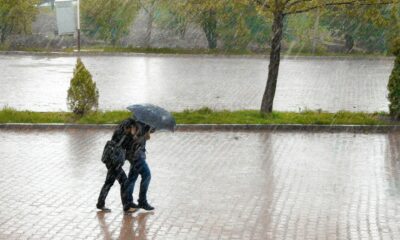
If it feels like the rain just will not let up, you are not imagining things. Large parts of South Africa are in for days of unsettled weather, with forecasters warning that the current system driving the downpours is not quite done yet.
The South African Weather Service has flagged widespread showers and the risk of severe thunderstorms as a cut off low pressure system continues to sit over the country’s central interior. While this type of system is not unusual for autumn, it is known for bringing prolonged rainfall and sudden, intense storm activity.
Severe Thunderstorms Expected In Multiple Provinces
For now, the western parts of the country are expected to stay partly cloudy, offering a brief break from the worst of the weather. But elsewhere, skies will remain heavy, with scattered to widespread showers expected to roll through the day.
The biggest concern lies in:
- Gauteng
- The Mpumalanga Highveld and escarpment
- Southern parts of Limpopo
These areas are under severe thunderstorm warnings, with the potential for damaging winds, heavy downpours and localised disruptions.
Authorities have warned that even short bursts of intense rain can have real consequences, especially for informal settlements and low lying communities. Damage to infrastructure, vehicles and even livestock is a possibility if storm cells strengthen quickly.
Flood Risk In Vulnerable Areas
Beyond the thunder and lightning, there is also a growing concern about flooding, particularly along escarpment regions in Mpumalanga.
While the overall risk of major flooding remains relatively low, forecasters say localised flooding is possible, especially in areas with poor drainage. Roads, bridges and smaller settlements could be affected if rainfall intensifies over a short period.
For many South Africans, this is a familiar pattern. Cut off low systems often bring slow moving rain bands that linger over the same areas, increasing the risk of water accumulation and disruption.
Unsettled Weather To Continue Midweek
The current system is expected to begin moving out of the mainland by Tuesday, but that does not mean an immediate return to clear skies.
Weather conditions are likely to remain unstable into Wednesday, with more scattered showers and thundershowers expected across several provinces. In other words, umbrellas will still be part of the daily routine for a few more days.
Public Urged To Stay Alert
Forecasters are urging residents to stay informed and keep a close eye on official updates as conditions can change quickly.
Relying on verified information is key, especially during severe weather events where timing and intensity can shift within hours. Motorists, in particular, are being encouraged to exercise caution on wet roads and avoid flooded routes.
As South Africa moves deeper into autumn, this stretch of wet weather is a reminder of how quickly conditions can turn. For now, it is a case of staying prepared, staying dry where possible, and keeping an eye on the skies.