News
Severe Storms, Hail and Heat: South Africa’s Weather Forecast for Thursday, 8 January 2026
Storm clouds, heatwaves and hail: what Thursday’s weather really looks like across South Africa
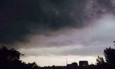
If you’re stepping out on Thursday, 8 January 2026, chances are you’ll be looking at the sky more than once. South Africa is in for a mixed bag of intense summer weather, from dangerous afternoon thunderstorms and hail to extreme heat and fire danger conditions.
The South African summer is doing what it does best: keeping everyone on their toes.
A country split between storms and scorching heat
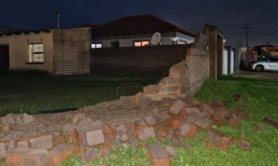
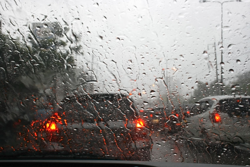
Large parts of the interior are bracing for severe thunderstorms, especially across the Highveld and escarpment regions. Social media chatter early this morning already shows residents sharing dark cloud build-ups, sudden temperature drops and lightning flashes a familiar sight for January, but no less disruptive.
At the same time, coastal and western regions are facing hot to very hot conditions, with fire danger warnings adding another layer of concern.
Provincial weather snapshot: what to expect where you are
Gauteng: classic Highveld summer drama
Expect partly cloudy skies turning warm, with the far north heating up quickly. Isolated afternoon showers and thundershowers could catch commuters off guard. UV levels remain moderate, but storms may arrive fast locals know these can turn roads into rivers within minutes.
Mpumalanga & Limpopo: storms with teeth
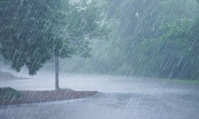
Both provinces are under heightened alert. While the day starts partly cloudy and warm, scattered afternoon thunderstorms especially along the escarpment and eastern areas could bring hail, strong winds and excessive lightning.
Free State: calm west, volatile east
Western parts stay fine, but the eastern and extreme eastern areas face isolated to scattered thunderstorms, some of which could turn severe by late afternoon.
North West: hot with sudden storms
Mostly hot and fine conditions dominate, but central and eastern areas may see isolated thundershowers, typical of late-summer instability.
Northern Cape: heat and fire risk
It’s another fine and hot day, but the bigger concern here is extremely high fire danger conditions, especially inland. Coastal winds pick up later in the day.
Western Cape: sunburn territory
Expect hot to very hot weather, with UV levels rated very high. Locals and visitors are urged to limit midday sun exposure, especially around Cape Town and inland valleys.
Eastern Cape: two very different days
The western half stays hot and dry, while the eastern side particularly near the Wild Coast starts cloudy with light rain, before clearing into warm conditions with isolated thunderstorms later.
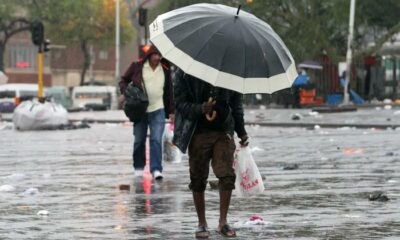
KwaZulu-Natal: humid and stormy inland
Morning fog lingers in parts of the interior, giving way to warm, sticky conditions. Scattered thunderstorms, especially in the west, could bring heavy downpours. UV levels sit at high, even with cloud cover.
Weather alerts you shouldn’t ignore
Severe thunderstorm warnings
-
Yellow Level 2: Mpumalanga, Limpopo, eastern Free State
-
Yellow Level 1: South-western KwaZulu-Natal
These storms may lead to localised flooding, hail damage, power disruptions and dangerous driving conditions.
Fire danger warnings
Extremely high fire danger conditions are expected across:
-
Most of the Northern Cape
-
Parts of the Free State and Eastern Cape
-
Central and north-eastern Western Cape
The bigger picture: why this matters
January storms aren’t unusual, but climate experts note that rainfall intensity and hail size have become more unpredictable in recent years. For many South Africans, this means planning daily routines around weather alerts, from school pickups to load shedding backup plans during lightning storms.
Bottom line? Keep an umbrella, sunscreen and a weather app handy, Thursday is shaping up to be anything but boring.
{Source: The South African}
Follow Joburg ETC on Facebook, Twitter , TikTok and Instagram
For more News in Johannesburg, visit joburgetc.com