News
SA Weather Service Issues Orange Level 9 Flood Warnings and Heatwave Alerts – 14 January 2026
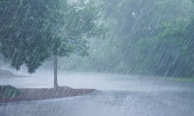
South Africa is facing a tale of two extremes this week, communities in the north and east are bracing for dangerous flooding, while large parts of the country bake under relentless heat and fire danger warnings.
The South African Weather Service (SAWS) has issued a series of high-impact alerts for Wednesday, 14 January 2026, with orange-level rainfall warnings in Limpopo and Mpumalanga, alongside heatwave and fire danger advisories stretching from the Northern Cape to KwaZulu-Natal.
For many South Africans, it’s the kind of weather day that brings anxiety rather than relief.
Weather forecast : 13 – 14 January 2026.
Widespread showers & thundershowers anticipated over Mpumalanga & Limpopo resulting in significant impacts of rain and flooding but isolated to scattered in the central, with chance of rain along the south-west coast.#saws pic.twitter.com/cxht2cjhd2SA Weather Service (@SAWeatherServic) January 13, 2026
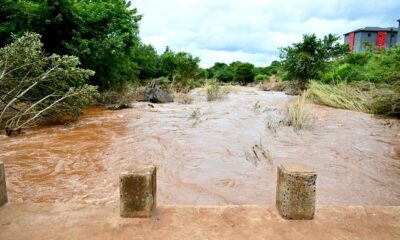
Flood risk escalates in Limpopo and Mpumalanga
SAWS has raised the alarm with an orange level 9 warning, its most severe, for parts of eastern Limpopo and the Mpumalanga Lowveld and escarpment.
This level of warning signals widespread flooding of roads and settlements, along with mudslides, rockfalls and severe soil erosion. Fast-flowing streams pose a real danger to life, while homes, infrastructure, livestock and livelihoods are at risk. In worst-hit areas, communities may be forced to move temporarily.
The warning affects Vhembe and Mopani district municipalities in Limpopo, as well as the Ehlanzeni district in Mpumalanga regions that have a long history of flood-related disruptions during peak summer rainfall.
Adding to concerns, SAWS has also issued an orange level 6 warning for central Limpopo and parts of the Mpumalanga Highveld. While slightly less severe, the risks remain serious, including flooded roads, damaged infrastructure and dangerous river crossings.
On social media, residents have already begun sharing images of rising water levels and muddy roads, with many urging neighbours to avoid unnecessary travel and heed local disaster management updates.
Yellow alerts widen the impact zone
Beyond the orange warnings, a yellow level 2 alert has been issued for parts of Mpumalanga, western Limpopo and northern KwaZulu-Natal.
This warning points to localised flooding in low-lying areas, informal settlements and near bridges, along with possible mudslides and erosion, conditions that often catch motorists and pedestrians off guard.
Fire danger and heat tighten their grip
While some regions are battling water, others are facing the opposite threat.
Extremely high fire danger conditions are expected across vast parts of the Northern Cape, as well as areas of the Western Cape, including Matsikama, Cederberg, Laingsburg and Prince Albert municipalities.
At the same time, SAWS has warned of a persistent heatwave affecting the Central and Little Karoo, the Witzenberg area, much of the Eastern Cape, the Free State, parts of the North West and eastern sections of the Northern Cape.
In some areas, conditions will be not just hot, but oppressively uncomfortable, especially in the north-eastern parts of the country, the Cape Winelands and sections of KwaZulu-Natal where humidity will compound the heat.
For farmers, firefighters and outdoor workers, these conditions raise serious safety concerns particularly after a dry spell following recent rains, which can turn vegetation into fuel.
What to expect in your province
Gauteng
Partly cloudy and warm, with isolated showers and thundershowers. Scattered rain is more likely in the extreme north-east.
Mpumalanga
Cloudy and cool to warm, with widespread showers and thundershowers in the east. Elsewhere, expect scattered rainfall.
Limpopo
Cloudy and cool to warm, with widespread showers and thundershowers, becoming more scattered in the south-west.
North West
Partly cloudy and hot, with isolated showers and thundershowers.
Free State
Morning fog patches in the east, followed by partly cloudy and hot conditions with isolated storms.
Northern Cape
Morning fog along the coast, then hot to very hot conditions. Isolated showers are expected in the east, while the west remains mostly fine.
Western Cape
Morning fog along the south coast and parts of the west coast. The day turns warm to hot, becoming very hot in the eastern interior. The UVB sunburn index is extreme.
Eastern Cape (western half)
Fine and hot to very hot, with extreme heat in the north-east. Isolated afternoon storms are possible.
Eastern Cape (eastern half)
Warm to hot, with isolated to scattered afternoon thundershowers, especially in western areas.
KwaZulu-Natal
Morning fog patches, then warm to hot conditions. The north will see widespread showers and rain. The UVB sunburn index is very high.
A reminder to stay weather-wise
From flood-prone villages to fire-risk farmlands, this week’s forecast highlights just how sharply South Africa’s summer weather can swing.
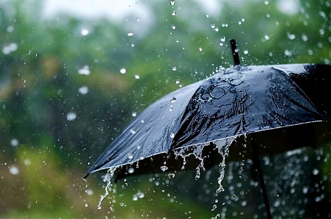
SAWS is urging residents to avoid flooded roads, stay away from swollen rivers, limit sun exposure, remain hydrated and follow updates from local authorities.
In a country used to weather extremes, the message for 14 January is clear: plan carefully, stay informed, and don’t underestimate the warnings.
{Source: The Citizen}
Follow Joburg ETC on Facebook, Twitter , TikTok and Instagram
For more News in Johannesburg, visit joburgetc.com