News
More Thunderstorms on the Way: SA Braces for Unsettled Start to the Week
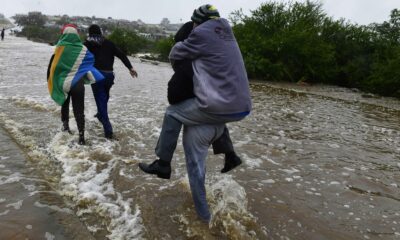
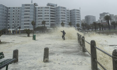
Following widespread thunderstorms and a Level 4 warning in parts of KwaZulu-Natal over the weekend, South Africans can expect more unsettled weather into Monday and Tuesday, according to the South African Weather Service (SAWS) .
Monday Weather
| City | Temperature |
|---|---|
| Pretoria | 30°C / 16°C |
| Johannesburg | 27°C / 15°C |
| Cape Town | 25°C / 15°C |
| Durban | 28°C / 23°C |
| Bloemfontein | 28°C / 15°C |
| Polokwane | 27°C / 17°C |
| Upington | 33°C / 22°C |
| Gqeberha | 23°C / 15°C |
| East London | 25°C / 18°C |
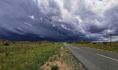
South Africans can expect cloudy and cool conditions in the east on Monday, with partly cloudy and warm weather elsewhere. Isolated to scattered showers and thundershowers are predicted, widespread over northern KwaZulu-Natal.
Tuesday Weather
| City | Temperature |
|---|---|
| Pretoria | 29°C / 19°C |
| Johannesburg | 28°C / 18°C |
| Cape Town | 25°C / 15°C |
| Durban | 26°C / 23°C |
| Bloemfontein | 29°C / 16°C |
| Polokwane | 26°C / 18°C |
| Upington | 34°C / 23°C |
| Gqeberha | 23°C / 16°C |
| East London | 24°C / 19°C |
Continued partly cloudy and warm conditions across much of the country on Tuesday. Showers and thundershowers persist over the central and eastern regions. Eastern areas remain cooler and more unsettled, especially in KwaZulu-Natal.
What to Watch For
-
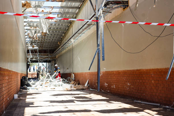
Risk of heavy rain, lightning and localised flooding, particularly in KwaZulu-Natal
-
Hotter, stable conditions in the west, with Upington peaking at 34°C on Tuesday
The Bottom Line
After a stormy weekend, South Africa heads into a humid and unsettled start to the week. Afternoon thunderstorms continue inland, while the west stays warm and relatively stable.
Stay safe, stay dry, and watch out for flooding in affected areas.
{Source: IOL}
Follow Joburg ETC on Facebook, Twitter , TikTok and Instagram
For more News in Johannesburg, visit joburgetc.com