News
Scientists warn South Africa may face a rare ‘Super El Niño’ only the fourth since 1950
Climate experts say a Pacific pattern could become only the fourth ‘Super El Niño’ since 1950. Forecasters warn of higher temperatures and likely below-normal summer rainfall.
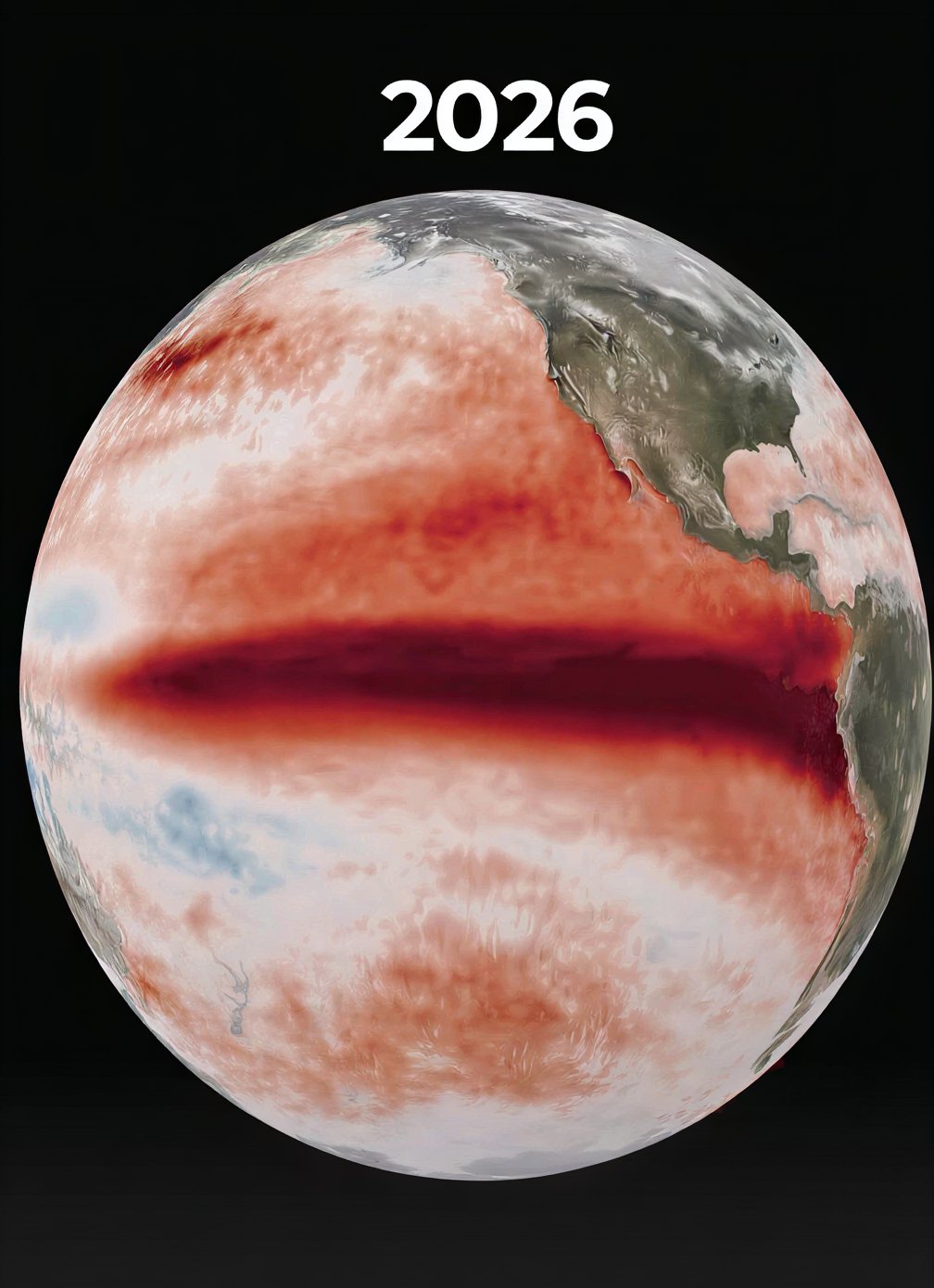
Climate scientists are tracking a Pacific Ocean pattern that could become only the fourth event of its kind since 1950, raising concerns about hotter conditions and reduced summer rainfall for South Africa.
How a “Super El Niño” is defined
“Super El Niño” is an informal term used when sea surface temperatures in the central Pacific exceed normal levels by more than 2°C a threshold meteorologists classify as “very strong.”
Agricultural meteorologist Johan van den Berg said the current event could become only the fourth to cross that threshold since around 1950, following the events of 1982/83, 1997/98 and 2015/16.
Chances and projected ocean warming
The US National Oceanic and Atmospheric Administration (NOAA) currently places the odds of this event reaching “Super El Niño” strength at more than 80%. Some Pacific waters are expected to run roughly 3°C warmer than average by the end of 2026, according to the reporting.
Regional impacts noted from past events
The most recent event of comparable scale, in 2015/16, had severe humanitarian consequences: it pushed more than 36 million people across east and southern Africa into hunger, affecting food security, water access and livelihoods.
Some climate models mentioned in the reporting suggest this developing event could exceed the intensity of each of the three previous events individually, potentially becoming the most intense since at least 1950. The coverage also stressed that every El Niño behaves differently.
What forecasters say for South Africa
The ENSO Reference Group has said the event is
“firmly established”
and will likely persist through the rest of 2026, with a real chance it strengthens further by late spring or early summer.
Forecasters expect above-normal temperatures from August through December. The reporting says the country’s summer rainfall region is facing increasingly likely below-normal rainfall from September to November, with that pattern expected to become dominant from October through December.
Where South Africa stands going into the season
The ENSO Reference Group noted that South Africa enters this season in a stronger position than during past droughts. The reporting attributes improved preparedness to healthy dam levels and soil moisture built up over the last rainy season.
Outlook and uncertainty
While forecasters and models indicate a heightened risk of a very strong El Niño, the reporting cautions that the outcome is not certain because every El Niño unfolds differently.
Follow Joburg ETC on Facebook, Twitter, TikTok and Instagram
For more News in Johannesburg, visit joburgetc.com
Source: thesouthafrican.com