News
Wetter September likely before a hotter, drier summer as El Niño strengthens
Meteorologists expect a wet start to September across central and eastern South Africa, then rising temperatures and El Niño-driven heatwave risk into summer.
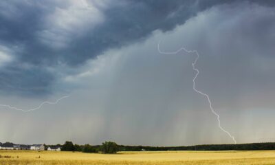
Spring will start with widespread rain in parts of South Africa in September, but meteorologists warn that a strengthening El Niño and high temperatures could push conditions toward a hotter, drier summer.
What to expect this September
Vox Weather meteorologist Michelle du Plessis said seasonal guidance points to a change in conditions early in September as a strong cut-off low develops over the country. “While parts of the country may see a wetter start to the season during September, especially across the central and eastern regions, attention is turning to the strengthening El Niño and what it could mean for the coming summer,” she said.
Du Plessis said the first half of September may bring wetter-than-normal conditions across parts of central and eastern South Africa, with above-normal rainfall possible over eastern parts during the second week. Wetter conditions could continue across sections of the central and eastern regions into the third week, she said. By the final week of September the pattern may become mixed, with below-normal rainfall possible along parts of the south and east coasts and wetter conditions in places across Limpopo, North West, the Northern Cape, Eastern Cape and Free State.
Recent context: a dry, unusually warm winter in places
Du Plessis said large parts of the Northern Cape and western interior experienced an exceptionally dry August, with some areas receiving only around 25% of their normal rainfall for the month. She added that several locations recorded one of their driest winters on record.
She also noted that the winter was unusually warm in many western areas.
“The winter was not only dry in many western areas, but also unusually warm,”
and analysis showed temperatures were between 2ºC and 4ºC above normal across large parts of the Northern Cape and portions of the Western Cape, North West, Free State and northern Eastern Cape.
El Niño and the outlook for summer
South African Weather Service lead scientist Christien Engelbrecht warned that a strong El Niño has formed in the Pacific and is likely to become very strong in spring. She said
“The latest weekly average sea surface temperature anomalies over the eastern central tropical Pacific Ocean are already exceeding the threshold that defines a very strong El Niño,”
and explained the thresholds that define strong and very strong events.
Engelbrecht added that
“The latest forecasts indicate the current event will very likely exceed the 3ºC threshold.”
She said past very strong El Niño events have had mixed impacts across southern Africa and noted the seasonal forecast for October to December indicates below-normal rainfall is the most likely outcome over most of South Africa and that the period is very likely to be associated with above-normal temperatures.
Engelbrecht said the rainfall and temperature forecast for November to next January is very similar to that of October to December 2026, with the most likely outcome being drier and warmer conditions over most of the country.
What this means
Forecasters expect a stormy, wetter start to spring in central and eastern regions during September, followed by rising temperatures and a seasonal outlook that favours drier, hotter conditions into the summer months as El Niño strengthens.
Follow Joburg ETC on Facebook, Twitter, TikTok and Instagram
For more News in Johannesburg, visit joburgetc.com
Source: citizen.co.za